SAVE THE SILVERDALE BOULDERS!
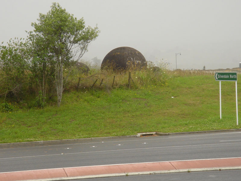
For almost forty years commuters driving between Orewa, and Silverdale have been intrigued by a set of huge spherical boulders at the side of the intersection leading to the Whangaparoa Peninsula.
The boulders, ranging from about 10-feet in girth diameter down to about 3 feet, were the subject of considerable controversy and discussion when they were first discovered in 1971. At that time, a new motorway was being constructed between Silverdale township and Orewa and the main obstacle in the way was the Silverdale Hill. As the bulldozer and big Euclid front end loader made their first cut into the crown of the hill they encountered a clustered set of about a dozen large concretion boulders. Thereafter, the bulldozer and digger drivers had to cut away the soil surrounding the stones in order to expose them. Later the boulders were shunted down to the western side of the hill where they were placed clear of the work area.
But there was a lingering and exasperating problem that needed to be resolved. The huge spherical boulders were "concretions", which can only "grow" in a sea sedimentary environment over millions of years. In some respects they grow like a pearl will grow in an oyster. A small stone or shell lying in the sea mud becomes coated with a thin layer of lime and sand, which then hardens over time. A second layer coats over the first and so-on until the original object potentially sits at the centre of many hundreds of coated layers.
As so often happens over millions of years, the sea floor can then be pushed upwards and become a part of dry land. However, the boulders will still be found sitting within the same lime and sand rich material from which they were formed. If they're found to be sitting amidst clay or other foreign material not conducive to their formation and growth, then chances are are they've been moved, by some means, to that new location.
This was one of the controversies that raged for a few days in the media in 1971. The visual evidence suggested that it was by ancient human intervention that the boulders had found their way from a suitable incubation environment within sea sediments to the top of this high, inland, yellow-clay hill. Workman were mystified about the out-of-place presence of the boulders and asked the Ministry of Works overseer, Clarry Neville how the stones got there? Mister Neville had no answers and simply replied, 'Your guess is as good as mine'.
Another factor noted by individuals inspecting the boulders, then and since, was that some were heavily incised with geometric patterns. It was quite obvious that humans had, at some remote era, cut designs into the surfaces of a number of the stones. It was equally evident that this concretion arrangement had been long abandoned, as so much soil had built up around them that they were fully buried when the Ministry of Works happened upon them in 1971.
Clarry Neville, was interviewed by newspaper reporters and asked about the anomalous boulder find. Mr. Neville stated that he was mystified as to how they got to the top of the hill. He stated that geologists, were going to investigate the matter and write up a detailed report, but the idea died a natural death and no satisfactory explanation was ever forthcoming from our experts.
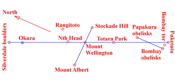
The concretion boulder arrangement was, indeed, a purpose placed structure. It formed a position in a straight-line arrangement of purpose-built structures that has been traced across the Auckland Isthmus for over 55-miles. The Auckland part of the ancient surveying alignment runs from Mt. William in South Auckland to a mound at Moir's Hill North of Puhoi. The other interim structures so far identified down this line are the mound at Totara Park in Manukau, the high southern side mound (centre crest) of Mt. Wellington, plausibly a now displaced and disturbed boulder cairn at Bastion Point, an ancient mound hump atop Okura Ridge, then the concretion cluster at Silverdale. Beyond that is Moir's hill mound, which is vaguely visible from the concretion position at Silverdale in clear weather.
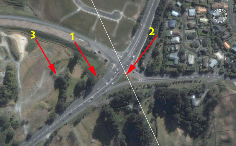
(1). This was the position where two of the largest concretions and some shattered smaller ones sat and were admired by passing commuters for almost 40-years.
(2). The white line shows how the ancient alignment though the Auckland Isthmus traversed the Silverdale position. The large crossroads intersection now sits directly beneath the former hill crown where the concretions were found and the triangular grass island would very closely approximate that position.
(3). In late April 2009 bulldozers shunted the large concretions, "out of sight-out of mind"down over the side of the hill onto an excavation where a new medical centre is being built. The fate of the huge boulders is unknown, but the prospects don't look good. Those that survived the trip over the bank have been given away by Rodney County Council to a private company (Southern Cross).
These "artefacts" are public property and Rodney County Council has no right to simply "give them away". Also, the cracked and broken concretions need to have their surfaces carefully checked by trained archaeologists for signs of ancient incised patterns and designs, as found on others from this Silverdale set.
To merely throw the broken ones away without thoroughly investigating them would be both a travesty and highly irresponsible. From a geological perspective alone, getting a glimpse into the heart of a concretion provides valuable insights about how they form in nature and the broken ones should, at least, be preserved as teaching aids to students of geology.
Some of the Auckland Domain concretions, procured from this Silverdale batch, were very heavily incised across their outer surfaces by ancient New Zealanders.
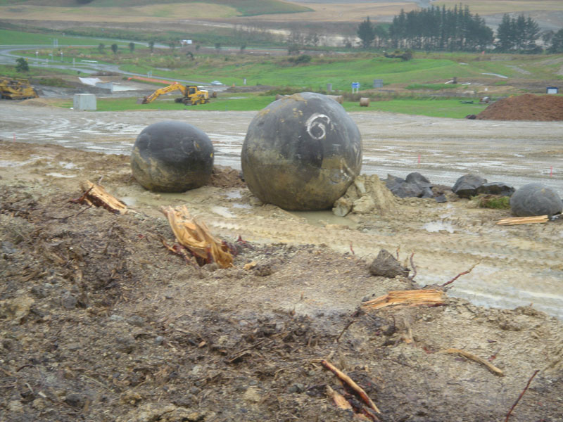
These ancient artefacts, which were once a part of a "purpose placed surveying structure", now face an uncertain future. The appropriate authorities at Rodney County Council were fully informed about the importance of these stones, but bare-faced lied to concerned parties who were seeking assurances that the ancient boulders would be preserved. Despite the false promises, the concretions were immediately thereafter machine shunted down the hill and received damage in the process of very rough handling.
Like "Humpty-dumpty" the shattered concretions need to be put back together again to whatever degree that's now possible. All of the survivors need to be put on display as a local icon, preferably on the grass island in the middle of the intersection (with a low crash barrier surrounding and protecting them from careless drivers).
So what are you and Rodney County Council doing with our ancient history Geoff?
Now let's look at the ancient marked alignment through Auckland, of which the concretion boulders at Silverdale were a component part.
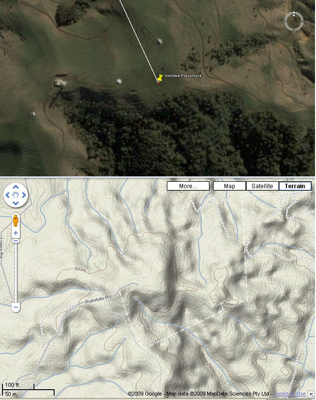
As one drives to the South of Auckland, Mt. William (Puketutu) looms up "larger than life" as the highest point, with radio masts adorning its high summit. For anyone who wants to explore up there, several ancient mounds and sighting pits (made for visual alignments onto far off targets) are in evidence. The Mt. William complex was a resolving area for incoming surveying alignments converging from around the Auckland Isthmus. Associated mounds on the Mt. William walkway high terrain served targets further South and West, like Pukemore Hill in Huntly and Pukekohe Hill.
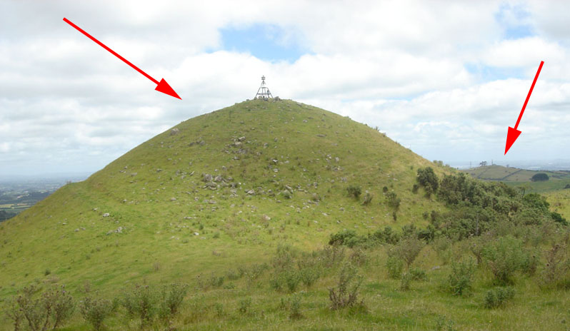
Two additional artificial mounds within or near the Mt .William walkway complex are shown. They once acted as resolving positions for surveying alignments across the Auckland Isthmus or for targets many miles to the South across the Waikato Valley. The Silverdale concretions were a component part of the overall surveying system that had been set up thousands of years ago by the pre-Maori people.
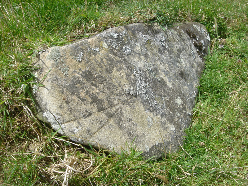
Lying on the side of the of the huge artificial and very ancient mound shown above is this incised stone. The shape of the stone is quite typical of the "shark's fin" marker stones that occur on many New Zealand "standing stone circle" sites. In most cases the stones are found lying on their sides like this one. Both the pointed end of the stone and the deeply incised arrow or pointer configuration at its base point directly at Pukekohe Hill to the West.
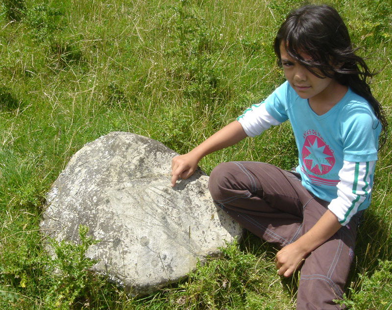
At the eastern base of the huge artificial mound is this (map?) boulder found by Wairua. She points to the intricate network of clearly evident incised marks across its entire surface and the only plausible conclusion one can draw is that the lines represented a map of the immediate region. A careful study might reveal that it refers to ridges, walkways, habitats, water and food sources, etc., in the near vicinity and was put there for wayfarers. These strangely nonsymmetrically-incised stones are found all over New Zealand, including along some very remote coastal track ways or forested walking ridges.
It's amazing that children can find, as well as immediately recognise the anomalous nature of these line-incised boulders, but our PC archaeologists can't.
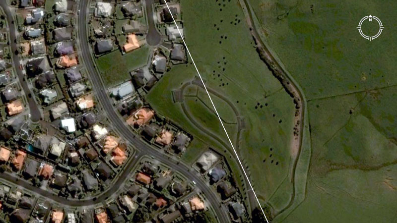
The ancient surveying line from Mt. William crosses over the artificial mound that the ancient pre-Maori Patu-paiarehe people built at Totara Park, Manukau. It relates, in a surveying sense, to Manukau Heads westwards and to an inland mound eastwards. It also has a strong relationship to laboriously excavated surveying positions on Mangere Mountain, etc.
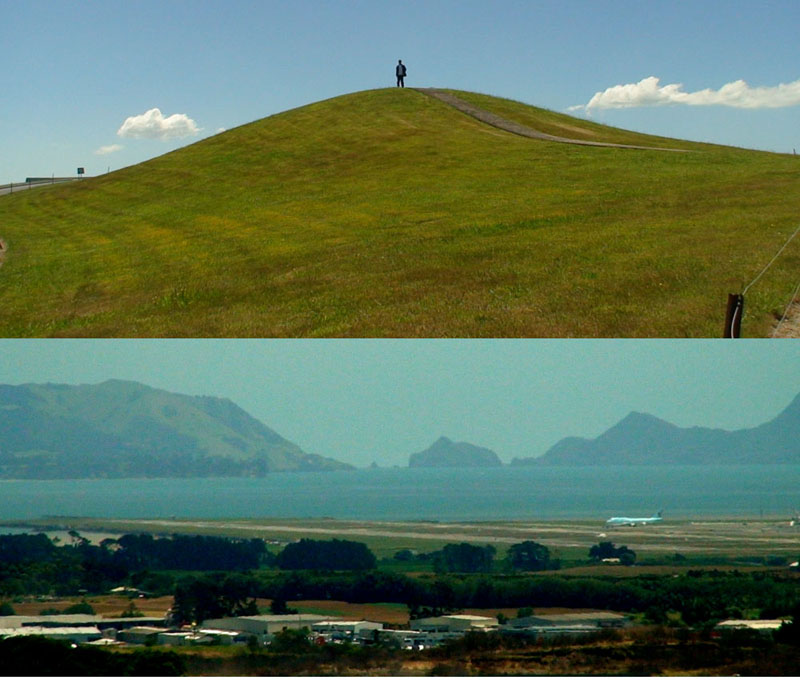
Totara Park mound was purpose built to stand in a precise position where a surveying line out to Manukau Heads (seen in this highly magnified picture) would brush both the southern and northern edges simultaneously. The sea level trough sits at an azimuth angle of 260-degrees. The mound was also a solar observatory for Solstice and Equinox sunrise and sunset fixes throughout the year.
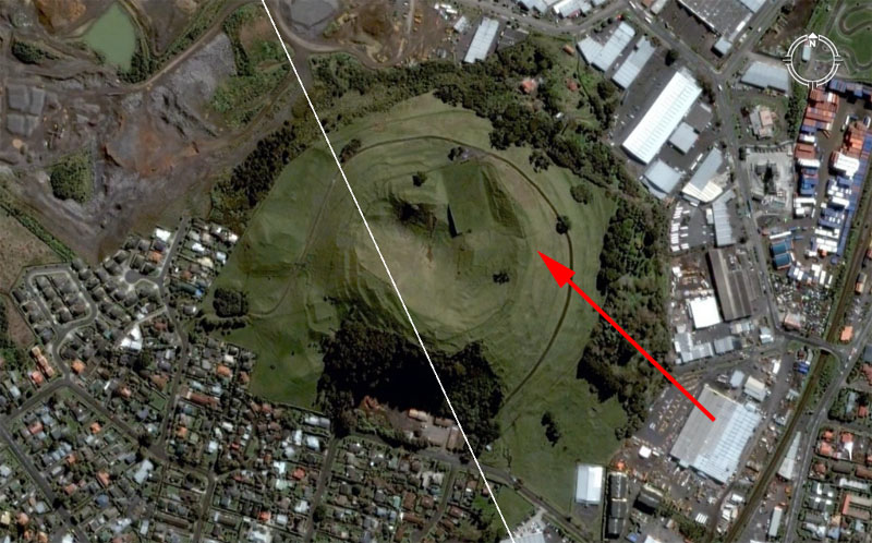
Here's the alignment line from Mt. William crossing Mt. Wellington and brushing the position of the high mound on the southern side. From here the line crosses Bastion Point, where the original marker cairn appears to have been plundered to provide ornamental boulders for the medical centre garden. The boulders at Bastion Point now sit off-line, but reasonably close to where they should be.
The red arrow shows the position of the Mt. Wellington crest trench. On the afternoon of the Equinox (Autumn or Vernal), the sun is seen to descend and land in the trench from the observer's position on Stockade Hill in Howick. British Army engineers (circa 1860's), had to remove the old Patu-paiarehe marker stones when they built the redoubt (defensive position) there. Alternatively, the Equinox sun can be observed to ascend from the Mt. Wellington trench from the observer's position at the ancient standing stone atop Mt. Albert.

undsoweiter ...
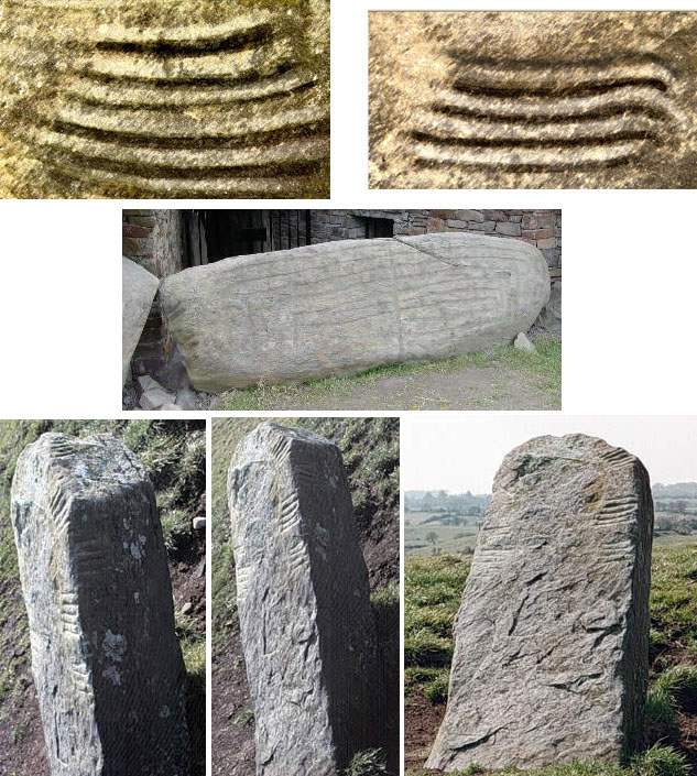
In this montage, the top left picture shows an enhanced view of the design on a Bombay (South Auckland) obelisk, whereas the right picture shows an enhanced view of the design on the second largest of the surviving Silverdale concretions (recently rolled over a bank). Both patterns are like flattened spiral or serpent-like designs that curve at the sides to form the next upward layer. A very similar pattern is found on a large boulder (centre) at the east gate of Knowth in Ireland, which dates to 3150 BC. Likewise, three views are shown of an obelisk in Britain bearing "Ogham" inscriptions. It can be seen that the same flattened or layered spiral method is used to form letters of an alphabet in this ancient form of writing.
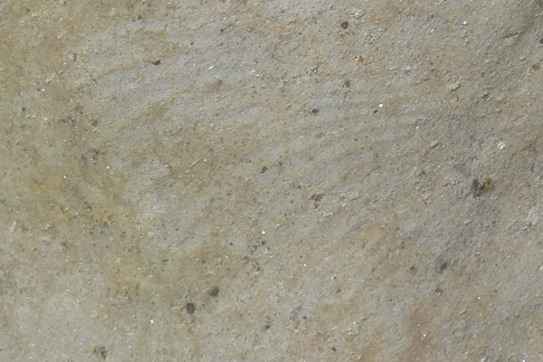
The stacked or meandering spiral design is vaguely apparent on this very weatherworn stone from the Hokianga, Northern New Zealand.
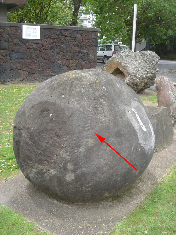
A taller stacked or meandering spiral of lesser width is visually apparent on this concretion boulder from the Silverdale group, on display at Auckland University. To their credit, the university accords this boulder full respect and has mounted it into concrete in order to preserve it from cracking and falling apart under its own weight. Rodney County Council inherited the very best examples or "pick of the litter"of these wonders of nature, but then treated them with contempt for the next 38-years.
Here are a few samples of incising found on the Silverdale concretions uncovered in 1971.
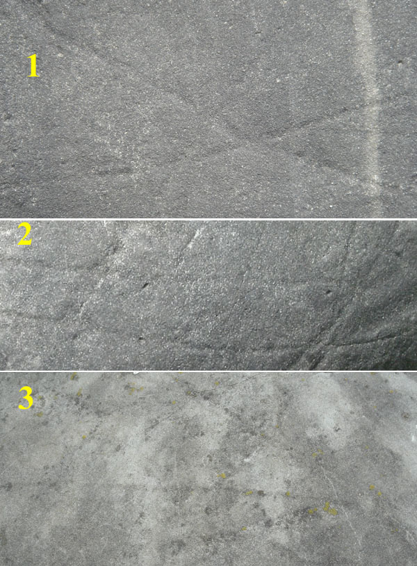
1. This is an "X" formed by incised crossing lines. It also has an arrow pointer traversing it on the diagonal.
2. This is a set of parallel lines with faint lines branching off them. The design is reminiscent of Ogham writing.
3. This is a very long arrow, extending for several feet over a boulder, suggesting a direction to some location. One heavily incised boulder at Stanley Street, in particular, seems to display all of the attributes of a map.
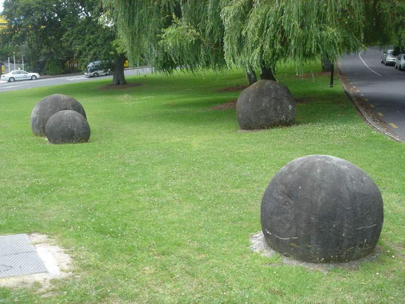
Four concretion boulders sit in a park setting at the Auckland Domain entrance. To the credit of the Auckland City Council, the boulders are being accorded the kind of respect they deserve and an explanatory brass plaque has been placed beside the display. The plaque reads:
'These boulders, known technically as concretions, grew in porous sand below ground. Lime (CaCO) being carried in solution in ground water and precipitated between the sand grains as cement. They come from rocks about 60 million years old. These particular boulders were obtained by courtesy of the Ministry of Works from the property of Mr. A.H. Grut of Silverdale.'*
*Note: Some scumbag has now stolen the brass plaque.
Each boulder has some incising of straight lines cut into their surfaces. The one in the foreground is heavily incised by single-lines, double-lines running in parallel, crossing-lines and arrow-pointers. It possibly represented a map giving directions for wayfarers to ancient locations in the vicinity of Silverdale?
Many concretion boulders were anciently used as solar observatories or other types of surveying marker positions throughout Northern New Zealand, ranging from Silverdale-Waiwera to the Dargaville district to Mangamuka near Kaitaia. Round boulders, including some concretions, were used as markers throughout the Diquis Delta of Costa Rica in remote antiquity. They were similarly used from Mexico to Bosnia in Continental Europe.
HOW ANCIENT SURVEYORS USED THE SILVERDALE HILLTOP ALIGNMENT MARKER FOR MORE EXTENSIVE OVERLAND MAPPING & TRIANGULATION CALCULATIONS.
Sitting marginally over 4-miles almost due North of where the 12 concretion boulders were originally found atop Silverdale Hill in 1971 is Chin Hill. This is a very high and impressive landmark, just inland from Hatfield's Beach. Ancient surveyors, setting up their manual theodolites amidst the concretion boulders at Silverdale Hill, could use a purpose-made excavation on the steep southern face of Chin Hill to set their instruments at a known, precise, degree angle. Thereafter, they could sweep the horizon with their alidade sighting-rule theodolites and get perfect fixes onto any chosen target throughout 360-degrees of vista.
The laboriously excavated surveying marker on the steep southern face of Chin Hill was so huge that it could be seen from as far away as the high, ancient mound trig atop Mt. Wellington (Maungarei, which means "the watchful mountain"), lying 25-miles SSE at an azimuth angle of 158.75-degrees. The fact is that the Chin Hill surveying excavation had been very carefully cut to accentuate light and shadow play with the rising and setting sun, thus making it stand out vividly from sighting positions a great distance away towards the South or from nearer in, like a series of surveying sites at Silverdale.
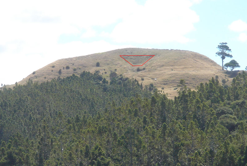
The ancient excavation into the southern face of Chin Hill is very impressive. Not only is the trench very symmetrical in the steep sloping of its back and side walls, but it has a long, wide and even floor section in the trough (an assembly area). There is further shaping and, what appears to be a small purpose built mound directly adjacent at a lower level and the whole design enhances the contrasting effects between light and shadow with the rising and setting sun. This very conspicuous surveying mark would have been very vivid from a great distance away to the South.
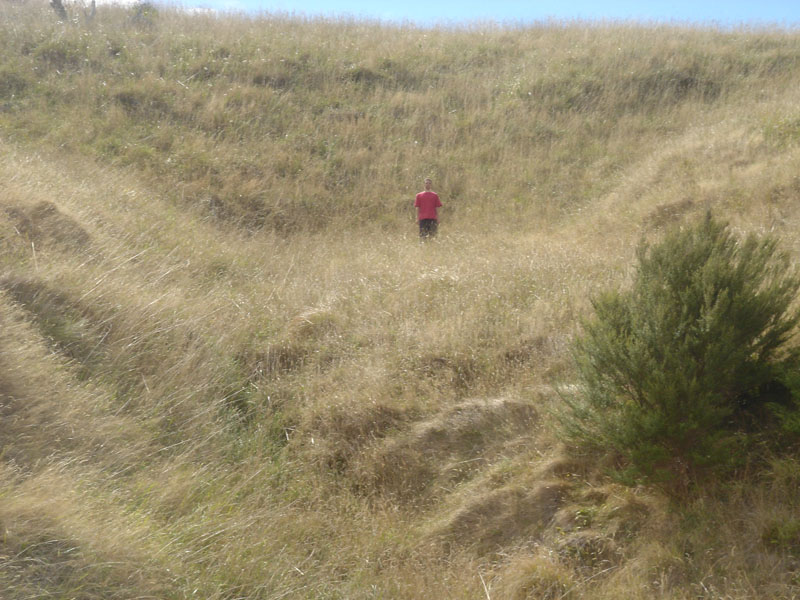
Gene stands on the wide and long floor of the ancient purpose-built hillside trough. Previously, we had asked at the farm house for permission to venture up to investigate this feature and promised to proceed with all due care. There is no farm road leading to the excavation or anywhere nearby and it's apparent that the huge excavation was done laboriously by hand. The terrain on every side is very steep and well beyond the ability of any vehicle to negotiate.
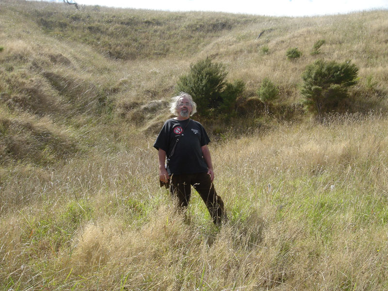
The author stands atop what appears to be a small purpose-built mound, situated at a lower level down from the Chin Hill excavation. Beyond this point southwards the terrain drops away very steeply and there is nothing in evidence to suggest that any kind of excavating machine could ever have driven to this spot. Like at so many other locations across New Zealand, this excavation served a very important surveying function to the ancient society that built it.
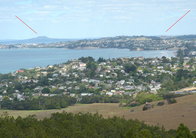
From the Chin Hill excavation the cone trough of Rangitoto volcanic island is seen 18.7-miles away at 148.6-degrees azimuth. Alternatively, Mt. Wellington can be seen 25-miles away at an angle of 158.75-degrees.
It seems quite apparent that the steep northern face of Chin Hill was similarly notched to provide a back-sight surveying position from high terrain to the North, like the twin domes of the Dome Valley, situated almost 14-miles away at 347.5-degrees. Some slumping and erosion seems to have occurred on the northern face of Chin Hill to semi-obscure the original symmetry, but an ancient surveying-related excavation appears to be in evidence on that side also.
THOSE SECONDARY CONCRETION BOULDER TRIG MARKERS AROUND SILVERDALE
As we now know, the 12 huge and smaller concretion boulders found atop the Silverdale Hill in 1971 sat on a line of structures spanning a 55-mile traversal of the Auckland Isthmus, from the Mt. William Walkway at Bombay to Moir's Hill mound situated North of Puhoi. Although that grouping of purpose-built surveying structures constituted the "main trunk line", there were, strewn along the path, many secondary surveying or solar observatory related structures.
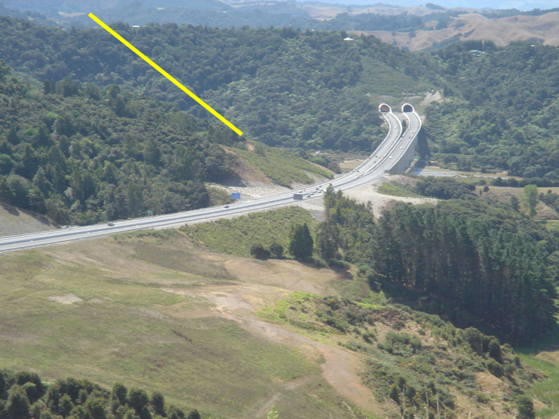
From atop Chin Hill one can look northwards to the new motorway tunnel. The yellow line shows the approximate position of Collin Weck's farm, situated above the Waiwera estuary, where double concretion boulders were hauled up the yellow clay hill to form a solar observatory. If one goes to the position of the boulders on Collin's farm, the equinoctial sunrise in the morning can be seen in the "V" trough at Waiwera Heads. The sun at the equinox also settles in a very distinct "V" trough of an inland hill range on the same afternoon. This gave ancient astronomer-surveyors a very finite fix regarding the true day of the equinox and the solar observatory still works perfectly.
Very near to where the 12 concretion boulders were found atop Silverdale Hill in 1971, other purpose-erected markers were found in the valley to the West. Let's look at these sets and try to determine the function they served for the ancient society who placed them at those exact positions.
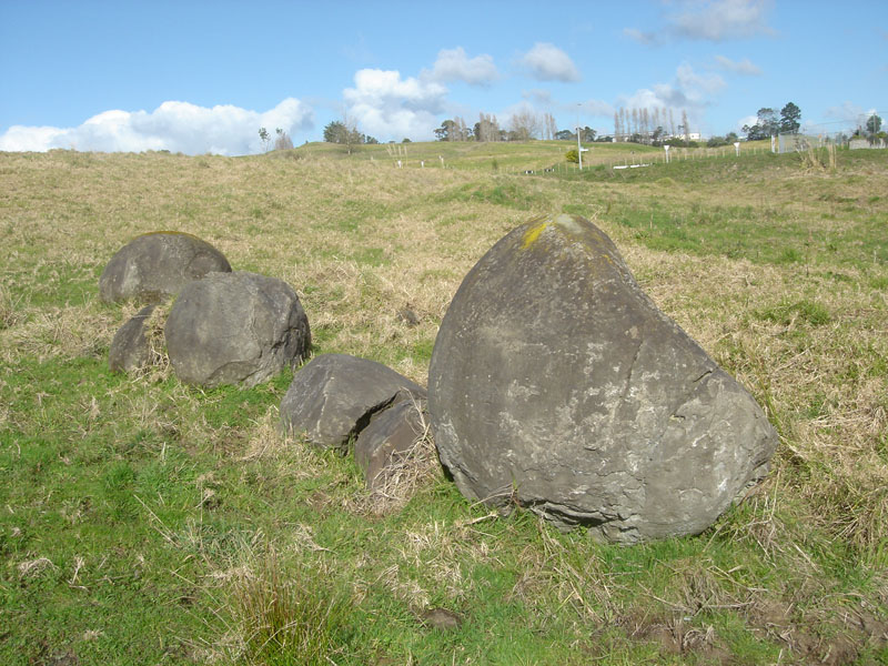
This ancient set of incised concretion boulders sat 2160-feet from the "main-trunk-line" set atop Silverdale Hill. The azimuth angle from this position to the main set was 113.4-degrees. The boulders might have been jostled around a bit at some stage of the colonial era, but appear to be at or very near to where ancient surveyors originally placed them on the surface.
What becomes glaringly apparent is that the distance from the main set of boulders on Silverdale Hill to this secondary set in the valley functioned as a "surveyor's baseline". One could go to either end of the baseline and take an angle shot onto the excavation marker on Chin Hill, then, using trigonometry, calculate the overland distance very accurately. Once the first large-scale triangulation was completed, that could be built upon to undertake distance calculations to targets further afield, including to outlying islands of the Hauraki Gulf.
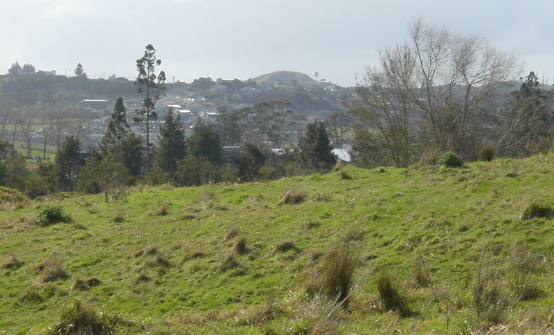
In a surveying sense, the reason the boulder trig was placed here was because it was in full view of Chin Hill (seen magnified), as well as the 12 concretions atop Silverdale Hill simultaneously. The distance to the surveying mark on Chin Hill from this secondary set of concretions was 4.2 Roman miles at an azimuth angle of 3.6-degrees.
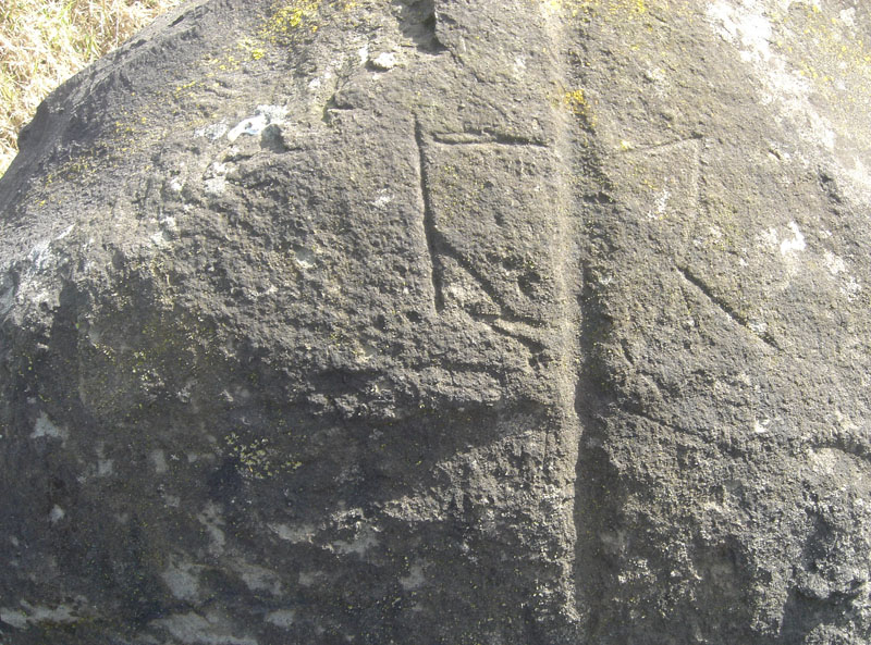
One of the very weather worn boulders in this grouping displays this geometric incising. A deep sighting line has been gouged out centrally, with right-angle and other intersecting geometry displayed to each side. Some careful surveying analysis should indicate what the incising means and, perhaps, help us to locate yet other secondary trigs in the region.
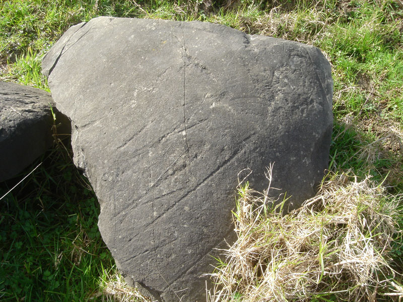
On yet another boulder adjacent are these long-stroke incised lines. Again, these would, undoubtedly, relate to targets on the horizon. There also appears to be a very faint flattened spiral, like one finds very vividly incised on one of the Bombay, South Auckland, obelisks found (in 1992) under a layer of volcanic ash from the 186 AD eruption of Taupo. A similar flattened or meandering spiral is found on the ancient Kupe stone at Omapere, Hokianga, as well as artefacts around Ireland dating to 3000 BC.
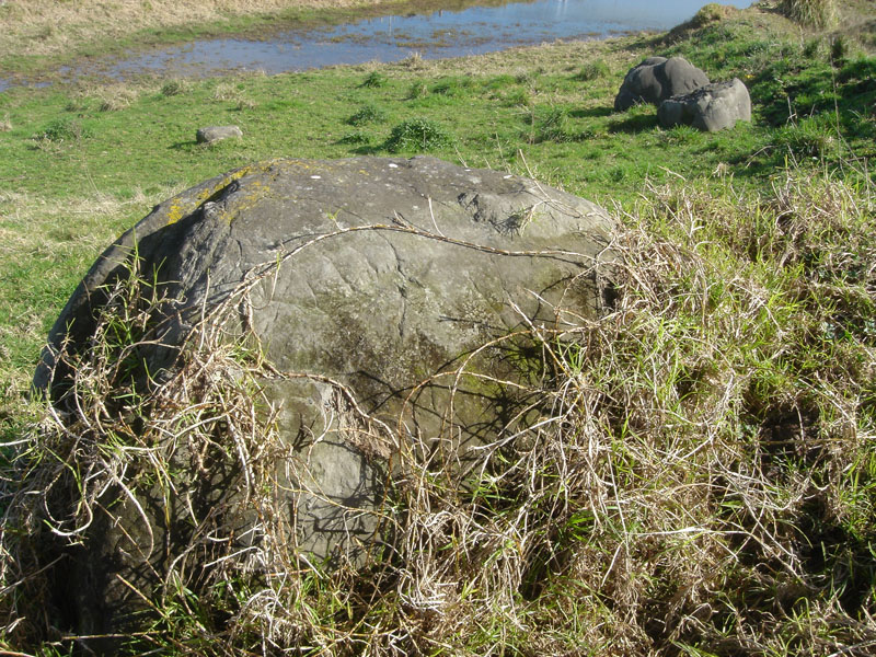
This is yet another set of concretion boulders further up the valley towards where the "main-trunk-line" concretions sat on Silverdale Hill. This grouping, as well as the incised set further down now sit directly in the path of developer's bulldozers and motor scrapers. It is unlikely that they will exist beyond next summer. This set sits closer to due South of the surveying excavation on Chin Hill. Before these sites are fully eradicated, they need thorough archaeological assessment, otherwise very significant information about New Zealand's pre-history will disappear under the brutal sweep of a bulldozer blade.
A FEW HOME TRUTHS FOR RODNEY COUNTY COUNCIL OFFICIALS.
Auckland City Council personnel had the foresight and intelligence to preserve the concretion boulders they "appropriated" from the Silverdale find of 1971, Rodney County Council has been grossly derelict in its duty since day one. In retrospect, the ACC should have taken them all to the Domain entrance at Stanley Street.
Archaeologists acting in an advisory capacity to RCC have, for some inexplicable reason, not noticed the ancient incising that is so clearly visible on the surfaces of several boulders from the Silverdale group.
Up until now, no member of the RCC (in almost forty years), has done one solitary thing to preserve these unique concretion formations as an exploitable tourist attraction or as display items for visiting school children on geological field trips.
Knowledge of some basic geology should have alerted RCC geotech engineers to the fact that finding a dozen or so concretion boulders on top of the highest yellow-clay hill in the district somehow constituted an anomaly worthy of scientific investigation.
Even the media of 1971 recognised the likelihood that these boulders had been taken up and placed on the top of the hill by human intervention at some very remote epoch. The find had the potential to be "history-changing".
Forbidden archaeology.
And that, world, is the abysmal state of archaeological and historical scholarship that we are forced to endure in New Zealand. Educated idiots, spawned by our university system, are utterly indoctrinated to be "politically correct" and aren't allowed to see anything in the landscape that detracts from United Nations "indigenous-rights" policies. Many hundreds of recorded anomalies, like those associated with the Silverdale boulders, are not allowed any honourable mention or scientific investigation, lest it somehow threaten the entrenched view that Maori were the original inhabitants of New Zealand.
The fact is that Maori historians have been very open in admitting that they were not the first residents of New Zealand, but encountered a long established civilisation living throughout the country, who they called the "stonebuilders" or the "surveyors". Maori oral traditions describe the original inhabitants as "uru-kehu" & "kiri-puwhero"... reddish, golden tinged hair - reddish, light complexioned skin ... with blue, green and other typically Caucasoid-European eye-colour tints).
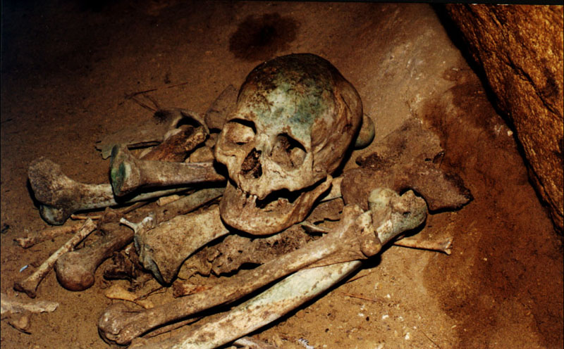
Here's one example of the thousands of Caucasoid "Moa-hunter" skeletons that can still be found in remote, difficult to get to burial caves around New Zealand. Because these skeletons are very different to the physiology of the Polynesian Maori, they're not allowed to be studied and,"officially", don't exist. When finds like this are reported to the authorities the remains are either destroyed or removed to secret sites and re-interred.
UPDATE, 7/5/09
Today, after a couple of abortive attempts to meet with people, Russell Ireland and I finally asked to see the Mayor of Rodney County. Thereafter, formerly unavailable people became available and assurances were given that the boulders would be protected from further damage.
We were subsequently promised that the broken, smaller concretions would be preserved and that we could organise a group to take all of the scattered fragments away and piece them together again for later restoration to the Silverdale site.
We were promised that the concretions would be restored to the very visible public position where they were admired by the public for the past 38-years.
We were promised that they would be housed within supportive concrete bases that would hold them together and support them intact for future generations, just as Auckland City Council did with the ones they took in 1971.
Ryan Bradley, Heritage Planner for Rodney, told us that there was no "Heritage Protection" classification related to the boulders. However, if we were prepared to pay Rodney County Council a substantial sum of money (just think of a ridiculously inflated sum ... then double it) then the council will consider the proposition.
We emphasised that the broken concretions need to be preserved and checked for signs of ancient incising across their surfaces ... like this one photographed today:
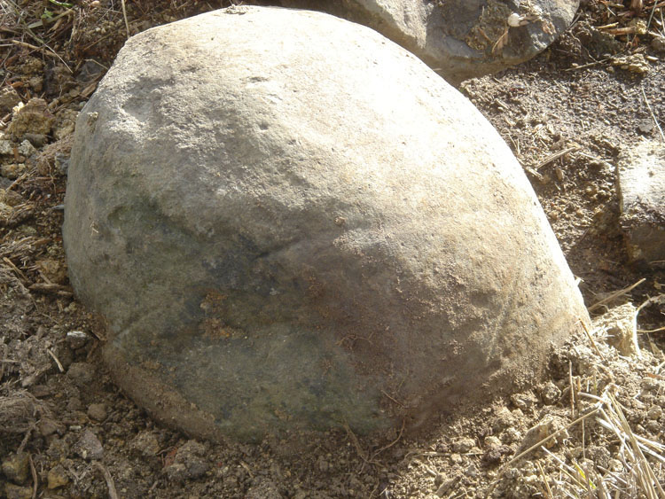
This fragment lying strewn along the path of the less than subtle bulldozer has a long incised stroke around what remains of its middle section, as well as more incising lower down. The boulder therefore contains information that was put onto its surface by some ancient scribe. So much time has elapsed since that action took place that the boulder became buried under humus at the top of the Silverdale Hill, until exposed again in 1971. It must be reiterated ... these concretions are artefacts that can help us understand New Zealand's prehistory. There remains a huge amount of archaeological and geological work that needs to be done regarding the incising, the in situ position of the find on a yellow clay hill and why the boulders sit on a line of structures that are spread out over 55-miles across the Auckland Isthmus.
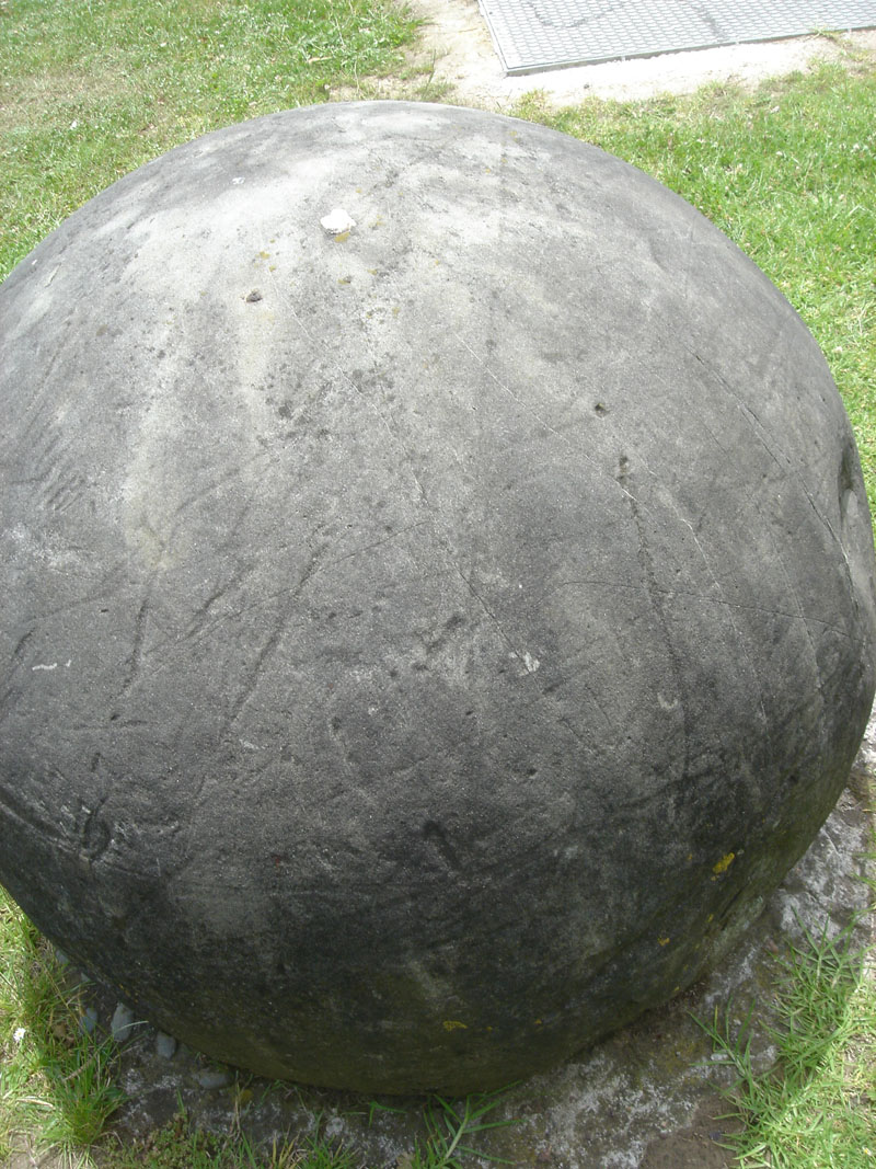
Here's one of the concretions from the Silverdale find of 1971, which sits at Stanley Street, almost within a stone's throw of University of Auckland's Archaeological Department. The boulder is covered with ancient incising marks, including an arrow pointer head with a long alignment shaft, as seen centrally in this photo. Prof. Harry Allen and his associates just up the road haven't noticed or professionally (scientifically) commented (although invited to do so several years ago) on the ancient markings, nor compared them to similar straight-stroke, line-incised stones that can be found all over New Zealand.
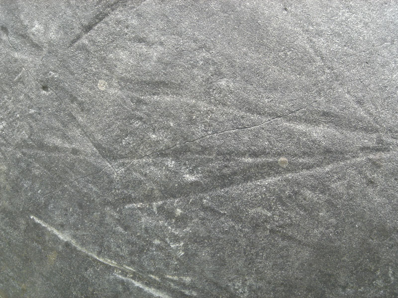
Here's yet another close up. A proper archaeologist would go over these boulders very carefully, take rubbings, measure erosion of the incised marks due to weathering, compare the directions shown by the markings with the actual geography of Silverdale region, etc., etc., but that will never happen in the foreseeable future. As a very poor substitute for actual scientists, providing very sound and well researched reports for the New Zealand public, we now have a big gaggle of "naysayers" who discount any unwanted anomalies with "off-the-cuff" remarks devoid of any serious investigation. The public are expected to accept without question the unresearched conclusions of these social-engineer "experts"and anyone who doesn't roll over compliantly gets labeled a "conspiracy-nut", "racist", "neo-Nazi" or whatever it takes to discredit them. The true scientific issue is never addressed, but the individual who raises it is attacked.
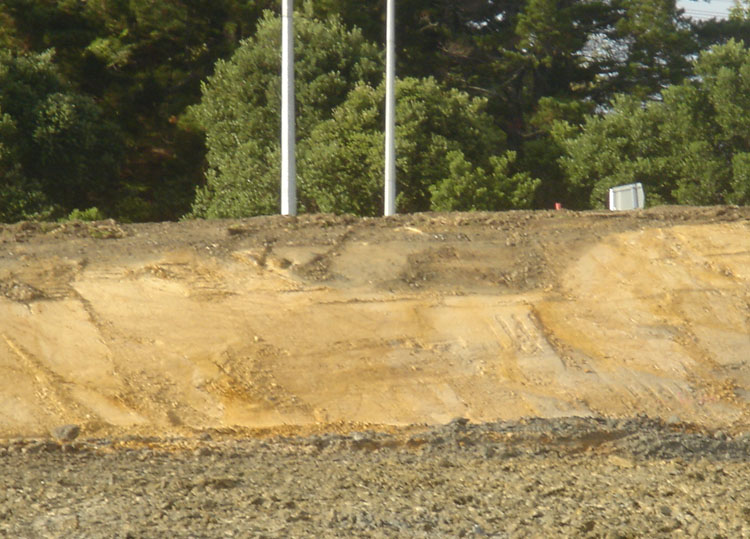
And here's some of the yellow clay (freshly exposed) that the batch of a dozen or so concretions were sitting on top of when found in 1971.
Would some geologist like to take samples for the inquisitive New Zealand public, then write a comprehensive, honest report telling us how the Silverdale concretions grew in this material?
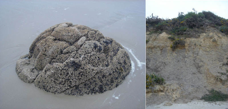
Here are photos taken by the author at Moeraki Beach, South Island of New Zealand in 2007. This is the location of the world renowned "Moeraki Concretion Boulders". The picture to the left shows one of the very eroded, sea-washed boulders that fell out of the slowly eroding cliff and flopped onto the beach. The picture to the right shows the eroding cliff, which contains concretions in its (former seabed) sedimentary layer. The top zone of the cliff is composed of land washed yellowish clay and humus that has settled over the sterile sea sedimentary strata lower down. Some of that upper, yellowish clay-humus material, complete with plant-life, has slipped down the cliff onto the beach.
It is only this very grey looking, lower belt of the cliff at Moeraki, composed of lime-calcium-sand rich material, which provided the incubation environment where concretions could form in the watery ancient seabed. That's why the Silverdale concretions were such an anomaly when found in 1971, as they could not have formed within the very foreign materials that surrounded them.
We're being subjected to "off the cuff" remarks by so-called experts ... like this one from Bruce Hayward:
'Geological Society spokesman Bruce Hayward said there was no mystery how the boulders got on the hill. He said they were 70 million years old and pushed up from the sea floor and the enclosing countryside eroded over time, leaving them exposed' (NZ Herald 6/5/09).
Well, first of all Bruce, they weren't exposed when found in 1971. They were under a thin layer of humus and sitting on landwashed clays (probably including some tephra bands from various volcanic explosions). Secondly, instead of trying to disarm us with unresearched and "off the top of your head" answers to very serious geological, archaeological and historical questions, please supply a detailed geological report, based upon soil and concretion composition samples from Silverdale Hill, which proves that the hill material was a suitable medium for the formation of concretions. It's time for some hard science.
Martin Doutré.
May 2nd 2009.
EPILOGUE
True to their word, the Southern Cross Medical Centre site contractors gathered up as many fragments of the broken boulders as they could retrieve and delivered them to our assembly yard. Russell Ireland and his helpers now faced the very daunting task of trying to salvage whatever they could and splice the former alignment marker artefacts back together again.
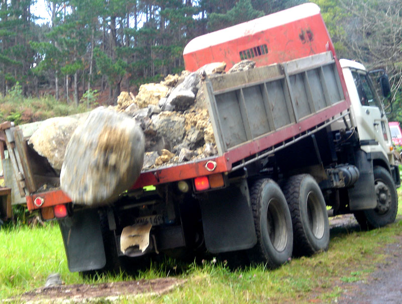
Some concretion fragments were huge and beyond the capacity of our on-site digger to lift, so we put down a thick block of polystyrene to cushion the fall of the large boulders at the back of the truck. Thereafter, the rest of the fragments were mixed within a large quantity of soft wet clay, which slid fairly gently from the truck without damaging the concretion fragments. The driver did an expert job, but encountered difficulty getting out of the soft ground after delivery was completed.
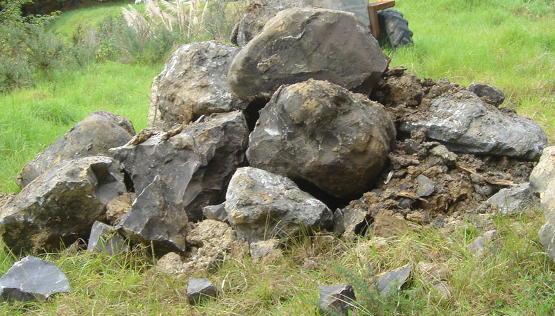
Good grief! This has got to be the ultimate nightmare jigsaw puzzle. How do we put this set of Humpty-Dumpty's together again? Is it even within the realms of possibility?
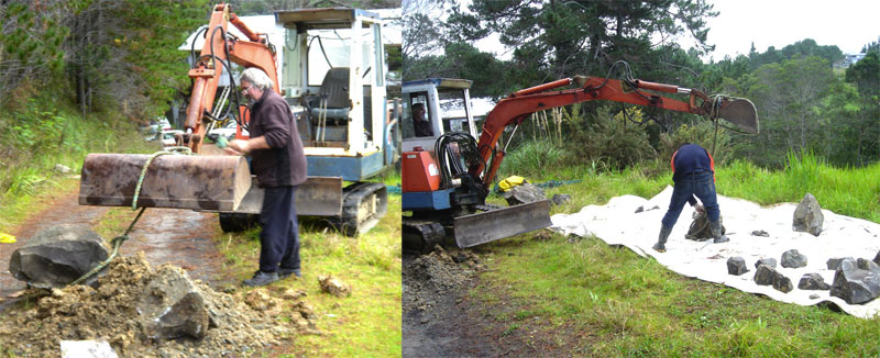
Next came the task of carefully taking apart the pile. The heavy fragments were sling-lifted or dragged with care to a large ground sheet where sorting could begin. Later they were cleaned and batched together as the probable or identified parts of individual boulders. The fragments were also closely scrutinised for signs of ancient incising.
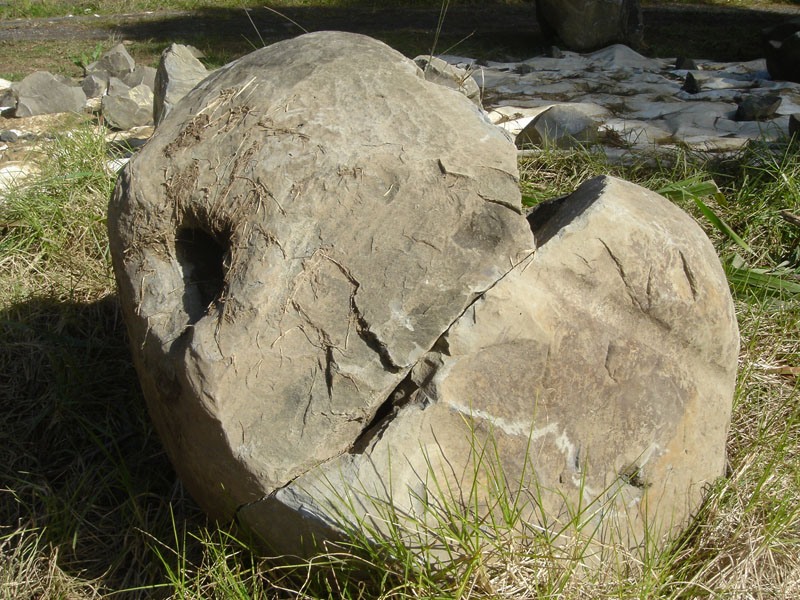
Bit by bit, parts start making sense and the boulders start coming together.

The ultimate jigsaw puzzle solvers, Russell Ireland (left) and Gene Doutré (right background). By dedicating their weekends to the task, over a period of three months, they were able to find out where almost all of the available fragments slotted back into place. The project has been hampered and slowed by the fact that it had to be done over the very rainy Winter period.
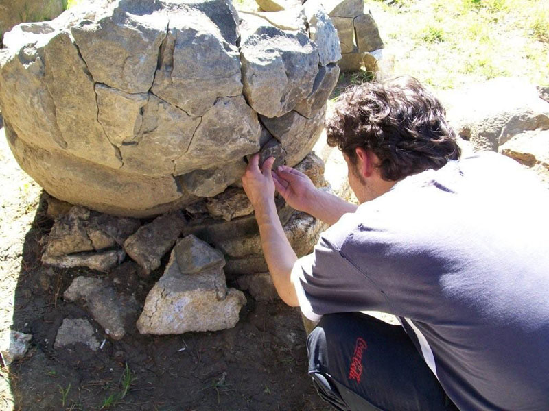
Gene attempts to place yet another fragment into this boulder and was successful.
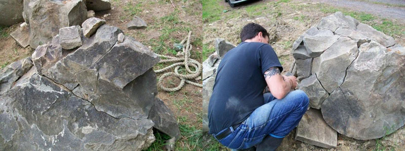
Russell (Eagle-eye) Ireland demonstrating his spatial skills once again. Russell remains the undisputed champion in putting the rock jigsaw puzzle together and found homes for the most pieces.

Russell digs over and sifts through what's left of the clay pile to retrieve the last of the concretion fragments in hopes of finding essential little bits to fill holes.

Russell scrapes damp clay away from a newly found fragment. Shona completes the task of scrubbing the last of the bits clean. They organised the project to save the concretions and have worked tirelessly and consistently over several months to complete the very difficult task
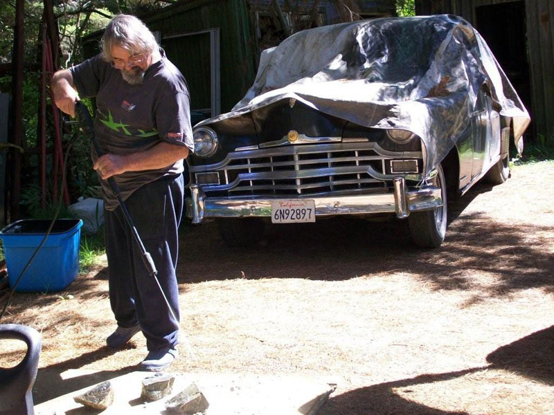
Martin water blasts more clay smeared rocks while Walter P. Chrysler looks on approvingly.

Two views of the assembly area. The trusty old cement mixer waits to be cranked up if needed to fill large missing sections. Later, these reconstituted areas of the concretions would be placed face down in a concrete base in the final garden setting at Silverdale, with only complete or original sections of the concretions visible.
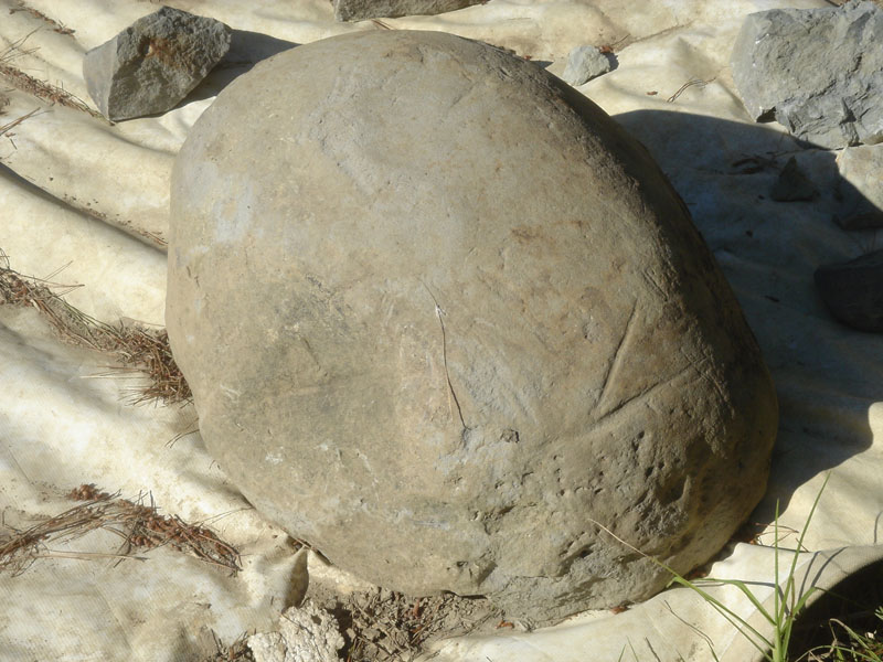
Not a lot of ancient incising has been found during reconstruction of this set of broken boulders, but here's some. The individual who made this arrow pointer mark lived and died potentially thousands of years ago and we'll never now know what the arrow was pointing towards. The best examples of incising from the Silverdale set are found on the boulders moved to the Domain entrance in 1971.
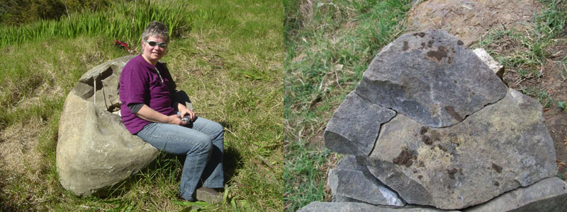
Left: Paula, who takes the majority of photos week by week and keeps a digital record of how the boulders are coming together, reposes in a concretion boulder armchair. To the left is seen yet another of her many photos.

The next stage will be the tedious and careful process of gluing the fragments back together with structural epoxy kindly donated specifically for the purpose by Wairau Paints of Wairau Rd, Glenfield, Auckland. That process will be followed by grouting and filling in missing sections with cement-mortar. It is anticipated that about 4 boulders will be substantially restored so that they can go on display in a garden setting at Silverdale alongside the giant concretions still in situ there. Hopefully, enough of the ancient Silverdale alignment marker components will survive, so that they can one day be officially recognised for what they truly represented to the ancient New Zealand people who hauled them to the top of the highest yellow-clay hill in the region.
Martin Doutré
September 6th 2009.
Endnote: March 2010 ... the project is now completed and the fragmented concretions are back together again. We await pickup from the site developers, so that the reconstructed boulders can go on display, alongside other survivors, at Silverdale.